Map of London, 16th century (C026/8906) Phone Case
1500s Phone Case
designed and sold by SciencePhoto
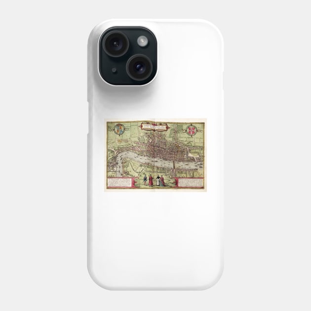
Map of London. 16th-century map of Tudor London, titled 'Londinum Feracissimi Angliae Regni Metropolis'. In the top corners are Tudor (left) and City (right) coats-of-arms. Latin inscriptions (bottom corners) describe the city economy. Manor houses link the city with the royal court at Westminster (left). London Bridge (centre right) leads to Southwark. The spire of St Paul's Cathedral (destroyed 1561) is visible. The vignette (lower centre) shows local dress. This is a 1612 edition of a map first published in volume 1 (1572) of the city atlas 'Civitates orbis terrarum'. This atlas was edited by Georg Braun (c.1540-1622) and largely engraved by Franz Hogenberg.

More Map of London, 16th century (C026/8906) Products
People Love TeePublic!
Not what you're looking for?
Try another search.

Product Quality
Our Production Team establishes the highest quality standards for third-party printers who participate in the marketplace to ensure that every product sold is perfect.

1500s Phone Case FAQ
UPS MI Domestic (6-8 Business Days)
FedEx 2-Day (4-6 Business Days)
Estimates include printing and processing time.More Shipping Info
We want you to love your order! If for any reason you don't, let us know and we’ll make things right.Learn More
Similar to Map of London, 16th century (C026/8906) Phone Case
More 1500s products
Customers Also Search
More content to explore
Artist's Applied Tags
Trending Tags
The links above have been automatically generated based on tag usage by third-party designers on the TeePublic platform.