1830 Map of the East India Islands Posters and Art Prints
Sumatra Posters and Art Prints
designed and sold by historicimage
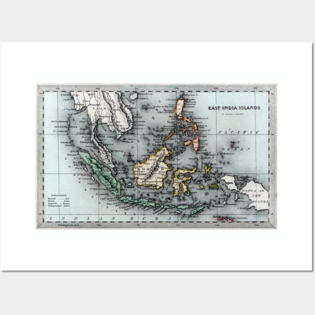
C. 1830 map of the East India Islands. In the lower left hand corner an explanation of the color code used within the map. Regions colored red are held by the British, regions colored green are held by the Dutch, regions colored brown are held by the Spanish and yellow colored regions are independent. Regions and countries depicted include Sumatra, The Philippine Islands, Borneo, Siam, New Guinea, Celebes and Java among many others.

More 1830 Map of the East India Islands Products
People Love TeePublic!
Not what you're looking for?
Try another search.
Product Quality
Our Production Team establishes the highest quality standards for third-party printers who participate in the marketplace to ensure that every product sold is perfect.

Sumatra Posters and Art Prints FAQ
UPS MI Domestic (6-8 Business Days)
FedEx 2-Day (4-6 Business Days)
Estimates include printing and processing time.More Shipping Info
We want you to love your order! If for any reason you don't, let us know and we’ll make things right.Learn More
Similar to 1830 Map of the East India Islands Posters and Art Prints
More Sumatra products
Customers Also Search
More content to explore
Artist's Applied Tags
Trending Tags
The links above have been automatically generated based on tag usage by third-party designers on the TeePublic platform.